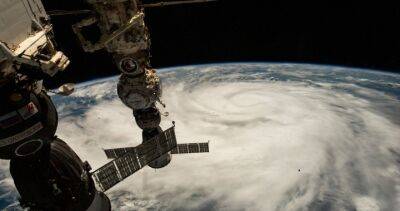
Hurricane Ian almost a Category 5 storm packing 155-mph winds as it nears Florida
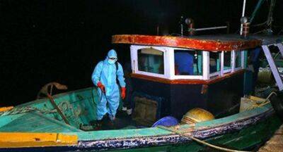
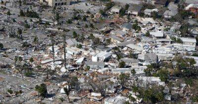
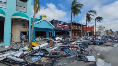
TAMPA, Fla. - Hurricane Ian’s winds rapidly intensified early Wednesday as it approached Florida, hitting 155 mph — a threshold just shy of the most devastating Category 5 hurricane status.The hurricane was expected to make landfall late Wednesday afternoon or early evening along the heavily populated Gulf Coast, with the Naples to Sarasota region at "highest risk" of a devastating storm surge.
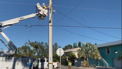
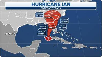
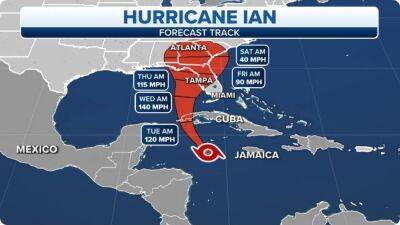
Other impacts could include strong wind, torrential rain, flooding, and widespread power outages.RELATED: Where will Hurricane Ian make landfall in Florida?Ian was centered about 55 miles west of Naples at 8 a.m., swirling toward the coast at 10 mph.The projected path and intensity of Hurricane Ian. "This is going to be a nasty, nasty day, two days," Florida Gov.
Ron DeSantis said early Wednesday, stressing that people in Ian's path along the coast should rush to the safest possible shelter and stay there."Do what you need to do to stay safe.
If you are where that storm is approaching, you’re already in hazardous conditions. It’s going to get a lot worse very quickly.


United States
|
Cases: 46 252 513
Deaths: 750 423
Recovered: 0
|

India
|
Cases: 34 321 025
Deaths: 459 652
Recovered: 0
|

Brazil
|
Cases: 21 835 785
Deaths: 608 235
Recovered: 0
|

United Kingdom
|
Cases: 9 215 683
Deaths: 141 607
Recovered: 0
|

Russia
|
Cases: 8 494 589
Deaths: 237 619
Recovered: 0
|